NEXRAD Radar Maps
Base Reflectivity

Features
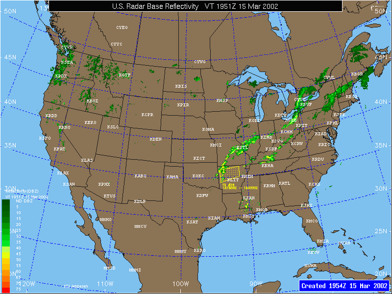
Base Reflectivity – 16 levels depicted with colors from dark green (very light) to red (extreme) that indicate the intensity of precipitation. Legend associates colors with intensity.
Severe Thunderstorm/Tornado Watch Areas – Yellow box indicates a Severe Thunderstorm Watch area. A Red box indicates a Tornado Watch area. Watch areas represent areas where the conditions are favorable for the development of severe thunderstorms or tornadoes.
Airport Locations – Selected airport locations are indicated on the background map using the 4 letter ICAO identifier in white.
NEXRAD radar base reflectivity measures the intensity of radar echo returns from precipitation particles. The larger and more dense the particle, the greater the return value. Reflectivity is generally associated with precipitation rate, such that the greater the reflectivity, the heavier the precipitation rate. It is also generally assumed that higher reflectivity values (above 40 DBZ) are associated with convective precipitation. Lightning and hail are more likely to be present with higher reflectivity values. Base reflectivity represents the lowest volume scan angle from the radar. The Jeppesen Base Reflectivity maps are national or regional mosaics, which combine the information from individual radar sites.
Maps are available every 6 minutes and contain the most recent NEXRAD mosaic. The actual valid time of the data may be a few minutes earlier than the creation time.
Echo Tops

Features
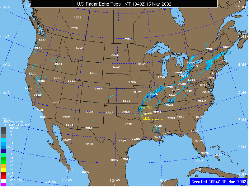
Echo Tops – 16 levels depicted with colors from gray (surface) to purple (70,000 ft) that indicate the altitude in hundreds of feet of the maximum precipitation returns. Legend associates colors with altitude of tops.
Severe Thunderstorm/Tornado Watch Areas – Yellow box indicates a Severe Thunderstorm Watch area. A Red box indicates a Tornado Watch area. Watch areas represent areas where the conditions are favorable for the development of severe thunderstorms or tornadoes.
Airport Locations – Selected airport locations are indicated on the background map using the 4 letter ICAO identifier in white.
NEXRAD Echo Tops depicts the height, in hundreds of feet, of the highest echo returns. The color palette used to define the height is displayed in the lower left corner. Different colors are used at 5,000-foot intervals from the surface up to 70,000 feet. Echo Tops represent the tops of the actual precipitation, not cloud tops. Sometimes cloud tops can be higher than echo tops, but do not contain precipitation. The Jeppesen Echo Top maps are national or regional mosaics, which combine the information from individual radar sites.
Maps are created every 6 minutes and contain the most recent NEXRAD mosaic. The actual valid time of the data may be a few minutes earlier than the creation time.
1 Hour Precipitation

Features
1 Hour Precipitation Accumulation – 16 levels of precipitation accumulation are depicted using colors from light gray (0.1 inches) to white (10.0 inches). Legend associates colors with 1 hour precipitation accumulation.
Airport Locations – Selected airport locations are indicated on the background map using the 4 letter ICAO identifier in white.
NEXRAD 1-Hour Precipitation represents the cumulative inferred precipitation that has been measured over the past hour. Precipitation amounts are inferred, as they are not actually measured by the NEXRAD radar, but the reflectivity values are associated with precipitation rates, and thus cumulative precipitation is inferred. The precipitation is "measured" by determining the reflectivity values and duration for which they existed over an area. The color palette in the lower left corner associates different colors to the cumulative precipitation received over the last hour. The Jeppesen 1 Hour precipitation maps are national or regional mosaics, which combine the information from individual radar sites
Maps are created every 6 minutes and contain the most recent NEXRAD mosaic. The actual valid time of the data may be a few minutes earlier than the creation time.
Radar Composite

Features
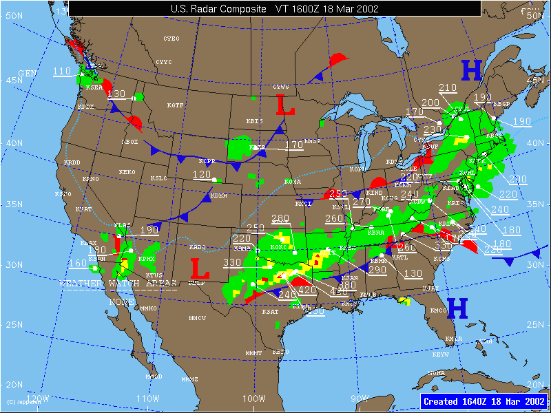
Precipitation Intensity – Light green areas represent light precipitation, yellow areas represent moderate to heavy precipitation and red areas represent extreme precipitation.
Echo Tops – 3 digit underlined numbers represent the altitude of the precipitation at the dot connected to the base of the number. Altitude is labeled in hundreds of feet.
Severe Thunderstorm/Tornado Watch Areas – Purple dashed lines enclose watch areas. The watch number is labeled near the box and the valid time of the watch area is depicted at the lower left corner of the map.
Surface Fronts – Cold fronts are dark blue, warm fronts are red, occluded fronts are purple and stationary fronts are alternating red/blue. Surface Troughs are dashed purple lines.
High & Low Pressure Centers – Blue H represents the center of high pressure, and red L represents the center of low pressure.
Surface Freezing Line – Light Blue dotted line depicts the surface 0 degree Celsius isotherm.
Restricted Visibility – Solid white lines with 3 yellow horizontal stripes in the middle represent areas where the visibility is less than 1 mile in fog, haze or smoke.
The Jeppesen Radar Composite map combines reflectivity values and echo tops as reported by the NEXRAD Radar Coded Messages (RCM). These reports are issued once per hour at 35 minutes past the hour.
Maps are created hourly at approximately 10-20 past the hour, and contain radar and surface data valid from 35 past to the top of the previous hour.